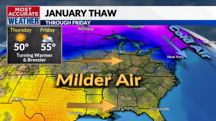
Monday, January 13 forecast: Frigid weather to follow a January thaw
2025 has been off to a very cold and snowy start. This January is nearly 7° colder than normal and our total snowfall is at 7.5" putting us 3" higher than the average for the entire month. Today was another cold day thanks to a reinforcing shot of cold air. The 40s over the weekend [...]

2025 has been off to a very cold and snowy start. This January is nearly 7° colder than normal and our total snowfall is at 7.5" putting us 3" higher than the average for the entire month.


Today was another cold day thanks to a reinforcing shot of cold air. The 40s over the weekend are gone with highs today in the low 30s. The good news is that a warming trend quickly sets in and we'll build our way into the 50s later this week.
In the short term, another cold night is ahead. Temperatures will drop quickly this evening thanks to clear skies, light winds, and snow cover. Temperatures are expected to rise after midnight as southwest winds and some clouds move in.

Southwest winds and some morning sunshine will quickly warm temperatures Tuesday morning before another cold front sends temperatures falling Tuesday afternoon.


The pattern looks pretty seasonable Wednesday before a January thaw kicks in Thursday and Friday. The big warmup is compliments of a pattern shift with a more west-to-east flow across the nation blowing out much of the frigid air.

The warmer temperatures will be the warmest of the new year, but it will also proceed the coldest weather of the winter.
The short period of warmer weather across the nation will be replaced with another broad trough across the country. A chunk of polar vortex will spin south toward the Great Lakes, delivering a brutally cold air mass.

The cold will build in Saturday with frigid conditions settling in for Sunday into early next week. This looks like the coldest air mass for our area since the extreme cold wave that hit the area during the middle of January 2024. Temperatures will likely remain below freezing for several days with lows that could dip below zero. Dangerously low wind chills and temperatures are expected Sunday through Tuesday morning. The cold could come in with a bit of light snow on Sunday, but amounts look very light at this stage. MLK Day looks like it could be one of the coldest on record for our area.
What's Your Reaction?


